Suffolk County Donates Global Positioning System to Brookhaven Lab for Educational Programs
June 14, 2005
UPTON, NY - Thanks to Suffolk County, the Long Island Geographic Information Systems Users Group (LIGIS), the Rauch Foundation, Hofstra University, and the U.S. Department of Energy's Brookhaven National Laboratory, about 200 ethnically underrepresented middle school and high school students from Freeport, Hempstead, Roosevelt and Uniondale school districts have had a unique, hands-on educational opportunity. They have learned how to use a global positioning system (GPS) to map out the habitat and movements of rare animals on Brookhaven Lab's 5,300-acre site.
 enlarge
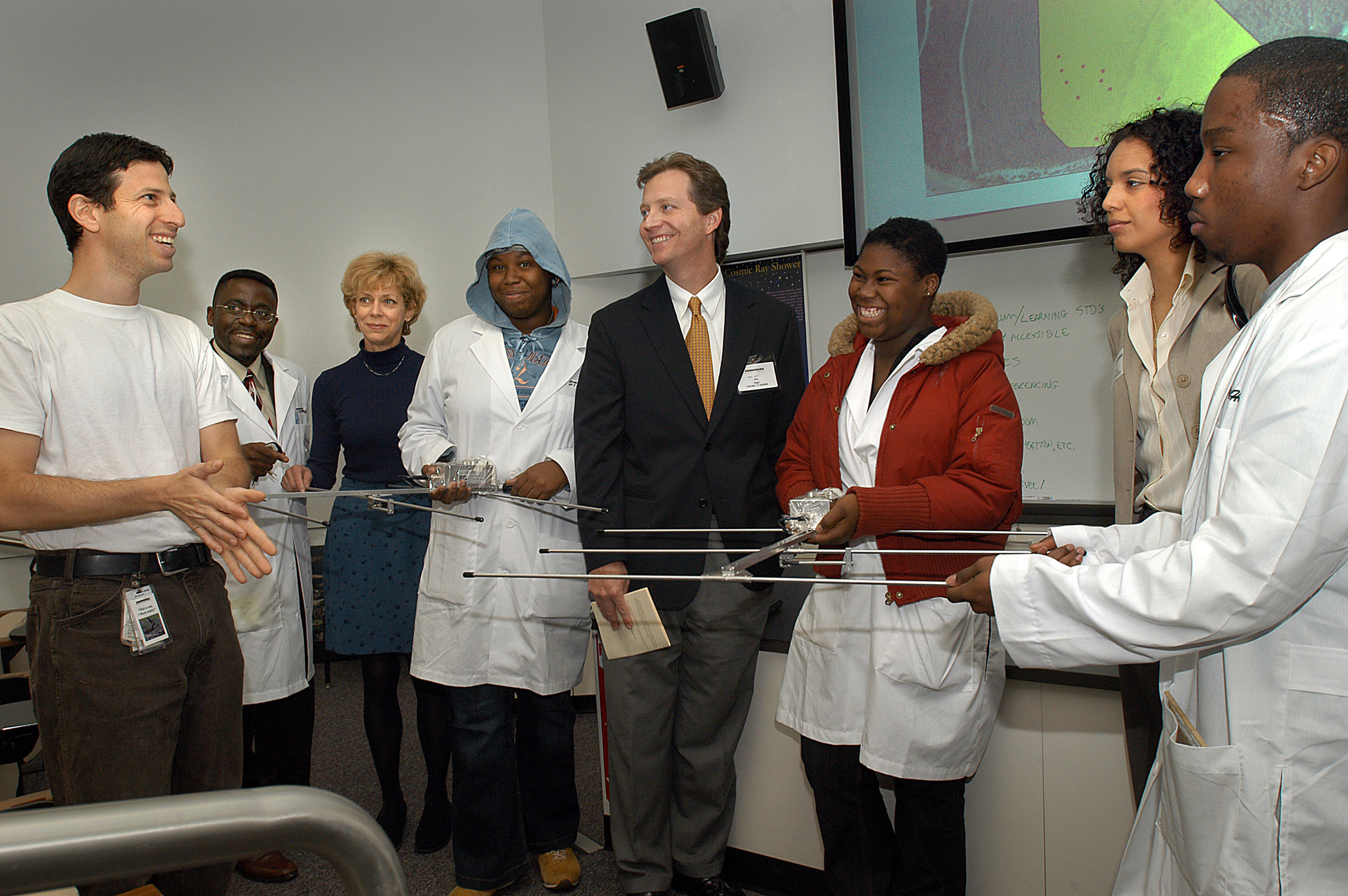
Jeremy Feinberg, a biologist and herpetologist working at Brookhaven National Laboratory (left, front), discusses the global positioning system donated by Suffolk County to Brookhaven Lab with (from left) M. Ehi Ayewoh, Hofstra University; Mary Daum, Brookhaven Lab; Melanie Walker, Hempstead High School (HHS) student; Jim Daly, Long Island Geographic Information Systems Users Group; Kendra Walker, HHS student; Maria Perez-Lent, Suffolk County Executive Office; and Maurice Allen, HHS student.
The students are part of Hofstra University's Science and Technology Entry Program (STEP), a New York State-funded program that aims to interest minority students in scientific, technical, and health-related fields. With the aid of Jeremy Feinberg, a biologist and herpetologist working at Brookhaven Lab, the students located "mock" animals using radio-telemetry, a technology that sends radio signals from a device carried by the animal. After pinpointing the animal's location, the students used GPS units to obtain precise coordinates of the location. They then entered the coordinates into a geographic information system (GIS) and developed a computerized map that showed the animal's travel range.
Rare animals on the Laboratory site include the spotted turtle, the Eastern hognose snake and the Eastern tiger salamander. According to Feinberg, the information provided by a GIS map can provide a better understanding of rare animals' movements and behavior. Then this information could be used in practical ways to protect the animals. For instance, certain areas of the Laboratory that are inhabited by rare animals can be deemed off-limits for lawn mowing.
"It is exciting that the technologies we could only dream about when we were school children are now everyday realities in the classroom," said Suffolk County Executive Steve Levy. "I'm pleased that Suffolk County could find an educational use for this GPS equipment, and I hope that it spurs the intellectual curiosity of many Long Island students."
Mary Daum, who works in Brookhaven Lab's Environmental Services Division, and a member of LIGIS, along with Jim Daly, the Chairman of LIGIS, initiated the negotiations for the GPS equipment, which had previously been used in Suffolk County's Stop-DWI Program. In addition, the Rauch Foundation lent their support to make the Hofstra STEP activities possible at Brookhaven Lab.
"This program was a great opportunity to show these students how their classroom learning can be applied to real world research projects," Kenneth White, Manager of Brookhaven Lab's Office of Educational Programs, said. "In addition to the STEP program, which had included lessons in physics and biology as well as environmental science, we plan to use the GPS equipment this summer for ninth-graders from Suffolk County and inner-city outreach areas in our Minority High School Apprenticeship Program and for tenth and eleventh grade students from Suffolk County in our Community Summer Science Program."
2005-10337 | INT/EXT | Newsroom