High School Students 'Think Spatially' at Brookhaven Lab's GIS Day
November 29, 2005
UPTON, NY - Sixty-eight high school students from Long Island and New York City learned about the numerous uses of geographical information systems (GIS) at GIS Day, an educational event held at the U.S. Department of Energy's Brookhaven National Laboratory. GIS is a system of computer software and hardware that combines information about a place to provide a better understanding of data related to it. GIS is used in a variety of ways, from analyzing weather and traffic patterns to assessing environmental damage or tracking the spread of disease.
 enlarge
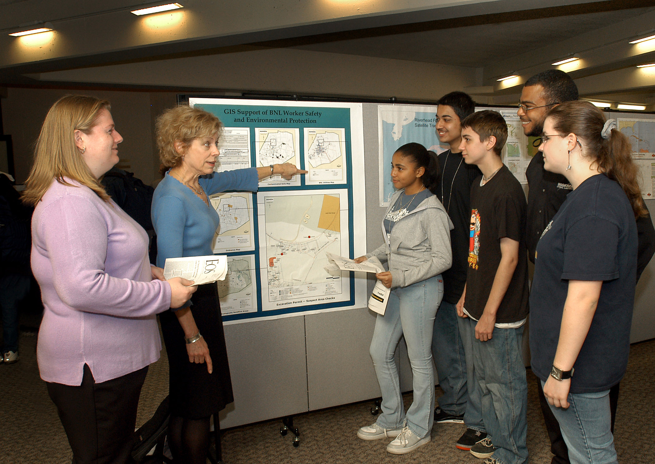
(From left) Brookhaven Lab's Jennifer Higbie, Mary Daum, and (second from right) Noel Blackburn organized GIS Day at Brookhaven Lab, where Long Island and New York City high school students learned all about geographical information systems (GIS). In the photo, Daum discusses a poster based on her work with Brentwood High School students (from left) Michelle Celestrin, Ahmed Bosit, Nick Summer, and Chelsea Smith. (Click image to download hi-res image.)
Held as part of the National Geographic Society's yearlong initiative called "Geography Action" and sponsored by the Long Island Geographic Information Users Group and Brookhaven Lab's Office of Educational Programs (OEP), GIS Day at Brookhaven Lab was part of an international effort to engage people in learning about geography and showcase applications of the GIS technology.
High schools participating in Brookhaven's GIS Day included Brentwood, Longwood, North Babylon, Shoreham-Wading River, and four high school districts in Hofstra University's Science and Technology Entry Program: Freeport, Hempstead, Roosevelt and Uniondale. Also attending the event were students in the Gateway/Explore New York City program, which prepares high school students for careers in medicine.
Mary Daum, one of the organizers of GIS Day at Brookhaven Lab and Information Technology Manager of the Laboratory's Environment, Safety, Health and Quality Directorate, said, "This was the second annual GIS Day held at Brookhaven Lab, and we had twice as many students participate compared to last year. We had a full program of workshops and many posters on display. One of the posters is based on my work that relates to the Department of Energy's Land Use Controls Management Plan. The map I created organizes many layers of information, from showing the location of contaminated soils to pinpointing sensitive wetlands or underground utilities, so it can be used, for instance, to determine where to locate a new building."
Jim Daly, Suffolk County GIS Coordinator and Chair of the Long Island GIS Users Group, was the keynote speaker at Brookhaven's GIS Day. He told the students to "think spatially." By thinking in terms of geography, students can start to understand GIS technology, which employs computers to store the information that experts use to analyze spatial information.
Among the workshops students attended were:
- "Using GIS to Study the New York State Salamander," taught by Valorie Titus, a doctoral candidate at Binghamton University who is working on her research with Brookhaven's Cultural and Natural Resources Manager Tim Green
- "Using Aerial Photography in Response to Hurricane Katrina," given by George Davis, Eastern U.S. Region Manager at Earth Resource Mapping, Inc., and a Long Island GIS Users Group member
- "Estimating the Deer Population," given by Jennifer Higbie from Brookhaven Lab's Environmental and Waste Management Services Division, and one of the organizers of GIS Day at Brookhaven.
2005-10398 | INT/EXT | Newsroom