
Groundwater Water Source
People living and working in Nassau and Suffolk Counties are completely dependent on groundwater for all of their freshwater needs. While Long Island is completely surrounded by salt water, the only source of freshwater is precipitation which becomes part of the groundwater system. Precipitation enters the groundwater system, or aquifer, by infiltration through the sandy, porous soil at Long Island’s surface. This underground aquifer system has more than enough water for present demands; however, saving water will ensure that future generations will always have a safe and abundant water supply.
Long Island Aquifer System
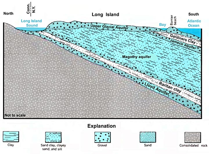
The Laboratory pumps its drinking water from five wells drilled into the Upper Glacial aquifer. The Upper Glacial aquifer is the topmost of the three major aquifers in the system and is located just beneath the land surface. BNL’s pumps draw up to 1,000 gallons per minute from the aquifer which is replenished by precipitation.
The precipitation, rain or snow, moves laterally in the Upper Glacial aquifer to streams and the shoreline or moves downward to the deeper Magothy and Lloyd aquifers. The aquifer system reaches a depth of some 2,000 feet at Fire Island. The major zone for recharge, especially to the deeper aquifers, is along the center of the Island where the water table is highest.
Pine Barrens Role
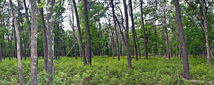
The Pine Barrens in Suffolk County, consisting of some 100,000 acres, are the last large nearly undeveloped area on Long Island. Due to limited development and their location within the deep recharge areas, the groundwater in this area is particularly pure. Several land preservation programs are in place to preserve and protect the Pine Barrens as both a unique ecosystem and for its ability to recharge groundwater.